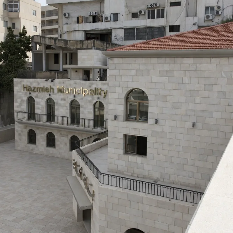
An ancient town, priding itself on its children and residents…
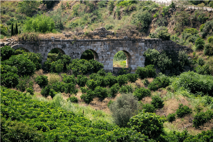
First monuments dated from the third century BC with the construction of Zubaydah barrages
Its star began to shine in the beginning of the eighteenth century
Today, it has a leading and distinguished role among Lebanese towns.

Geographical Location:
The town of Hazmieh is located in the southern suburbs of Beirut, at a distance of 6 km from the capital.

Limits:
– North: Beirut River and Sin El Fil Boulevard – the intersection of Chevrolet.
– West: Camille Chamoun Boulevard down to the intersection with Simon Gallery.
– South: from the intersection of Simon Gallery until El Sayad roundabout to the north and up to Rihaniyya Junction further north.
– East: the limits of the military school.

The Hazmieh region will become, more than ever, a link between all regions after the completion of the circular highway that crosses near Dar El Sayad roundabout. It is worth noticing that thanks to its strategic location, thousands of cars cross Hazmieh every day heading to various Lebanese regions.

Altitude:
Between 50 m and 200 m above sea level.

Area:
About 3 km² (specifically 2.73 km²)

Number of commercial units:
Around 2,000 units.

Number of housing units:
Nearly 7,500 units.

Number of residents:
About 55,000 people.

The population of Hazmieh is composed of the typical Lebanese ethnicity that belongs to all religious communities, and this is what distinguishes it from other towns.

Ref: Hazmieh municipality website 


لدة عريقة بفضل أبنائها وقاطنيهـــــــا …
 ظهرت معـالمهـا في القرن الثالث قبل الميلاد مع تشييد قناطر زبيده.
ومع بداية القرن الثامن عشر الميلادي بدأ نجمها يسطع
امـا اليوم فإنهـا تكتسب دوراً ريادياً ومميزاً بين البلدات اللبنانيـّــة.

: الموقع الجـغـرافي
 تـــقع بلـدة الحــــازميـّـــة في الضـاحية الجنـوبيـّـــة لمديــنــــة بيروت، على بعــد 6 كـلم من العـاصمــة.

: حدودهـــــــــــــا
–  شمــــــالاً :   نـهـر بيروت وبولفـار سن الفيـل  – تـقـاطع الشفروليه.
–  غــــــرباً  :   بولفـار كميل شمعون لغـاية تـقـاطع كـاليري سمعـــان.
– جـنـوبــاً  :  من تـقـاطع كـاليري سمعـان صعوداً حتى مستـديرة الصيـاد ومنـهـا صعوداً حتى مفرق الريحانية – شمالاً.
– شــرقـــاً :  حدود المدرسـة الحربيـّــة.

وستـصبح منطقة الحـازمية ، أكثـر ممـا كـانت دومـاً ، همزة وصـل بين كـافة المنـاطق ، وذلك بعد إستـكمال الأوتوسـتــراد  الدائري قرب مستديرة دار الصياد، علماً بأنه يعبر الحازمية يومياً آلاف السيارات المتوجهة إلى كافة المناطق اللبنانية، وكله عائد لموقعهـا الإستراتيجي.

: إرتـفاعهـا عن سطح البحر
تـرتـفع عن سطح البحر بين 50م و200م

 : مسـاحتـهـا
حوالي 3 كلم2 – تحديداً 2.73 كلم2

 : عدد الوحدات التـجاريـّـة
حوالي 2.000  وحدة.

  : عدد الوحدات السكنيـّـــة
 حوالي 7.500  وحدة.

 : عدد السـكان المقيمين
حوالي 55 ألف شخـص.

تتكون الحازمية من النسيج اللبناني المنتمي إلى كافة العائلات الروحية، وهذا ما يميزها عن غيرهـا من البلدات.